Hiking Mount Arrowsmith
Above the Valley, Beyond the Trail:
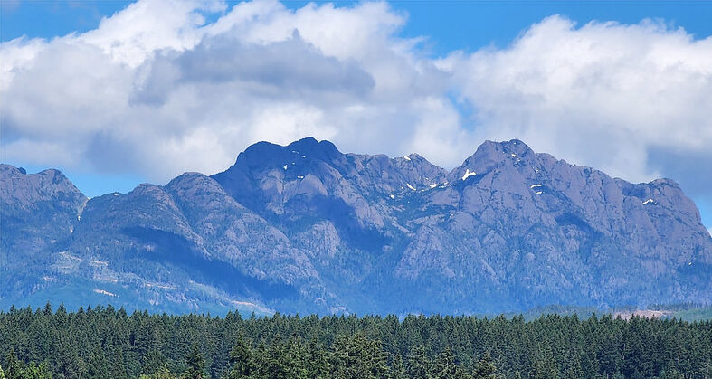
Mount Arrowsmith rising above the Alberni Valley, its jagged peaks defining the landscape year-round.
For as long as people have lived in the Alberni Valley, the jagged peaks of Mount Arrowsmith have drawn the eye upward. The mountain’s dramatic profile dominates the skyline, visible from town, nearby lakes, and the highways that connect the valley to the rest of Vancouver Island. Long before it became a destination for hikers and climbers, it was a landmark — a point of orientation embedded in the landscape itself.
Known to the Tseshaht and Hupacasath First Nations as Kulth-ka-choolth, meaning “Jagged Points Facing Upward,” the mountain has held significance for thousands of years. Its peaks served as navigational markers and were part of a broader cultural relationship with the land grounded in knowledge, respect, and stewardship. European explorers later applied the name Mount Arrowsmith in the mid-1800s, honouring British hydrographer Captain John Arrowsmith as colonial mapping of Vancouver Island expanded.
Early Climbers and First Ascents
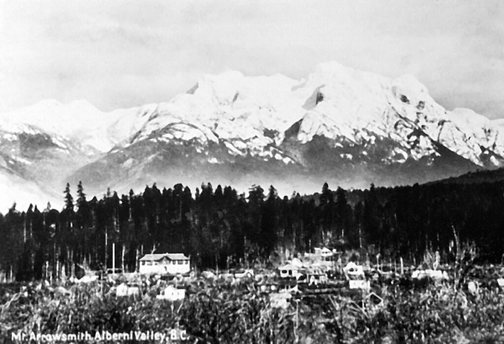
Mount Arrowsmith from Port Alberni circa 1914 | Source: Joseph Clegg photo
As mountaineering began to take hold on Vancouver Island, Mount Arrowsmith drew the attention of early climbers looking beyond more accessible peaks. Its steep relief, exposed upper terrain, and variable conditions made it immediately clear this was not a casual objective. Early ascents were driven less by recreation and more by curiosity, endurance, and the challenge of moving through complex alpine terrain.
One of the most vivid early published accounts of ascending Mount Arrowsmith appeared in the Daily Colonist in 1922, written under the pen name “Cumbrian” [Horace “Rusty” Westmorland]. In it, he describes an efficient weekend push to the summit from the Cameron Lake area in early summer, emphasizing just how much elevation the mountain demands from a relatively low starting point. He also captures something hikers still recognize today: conditions can shift quickly, snow can linger on the upper slopes, and what looks straightforward from below becomes more serious as the terrain opens up.
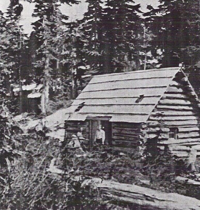
Cokely Cabin, CPR Trail via Cameron Lake | Source
Westmorland’s story includes details that still feel familiar a century later, including steeper zigzags after “the Bridge,” a mountain hut around the 4,000-foot mark, and a “hump” (a false summit) that has fooled more than a few parties into thinking they’d reached the top. His group pressed on to the higher peak through deep, firm snow, stepping carefully near steep slopes where a slip could have real consequences. As he put it, it’s easy to underestimate Arrowsmith if you judge it only by its summit elevation; what matters is how quickly you gain height from the valley below.
The Draw of the Climb
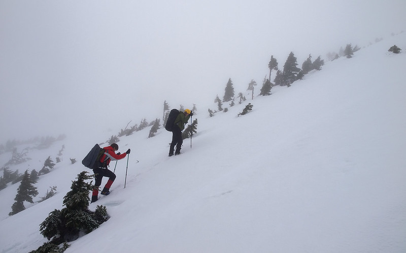
Elevation is gained quickly on Mount Arrowsmith as forest gives way to exposed alpine rock | Source: Andrey Skv
What continues to draw hikers to Mount Arrowsmith is not simply the idea of reaching a summit, but the experience of moving through a landscape that changes quickly and decisively. Elevation is gained rapidly, with forested slopes giving way to open alpine rock. Weather can shift without warning, snow often lingers well into warmer months, and visibility may change in moments.
These conditions shape both the challenge and the appeal. Hiking Mount Arrowsmith demands awareness, adaptability, and sound judgement — qualities that resonate with experienced hikers seeking more than a scenic outing. For many, the mountain’s appeal lies as much in the decisions made along the way as in how far they go.
To put that experience into context, the climb involves:
- Summit elevation: 1,819 m [5,968 ft]
- Distance and elevation gain: varies widely by route
- Judges Route: about 6.8 km return with about 1,021 m of elevation gain
- CPR Trail: about 23 km return with about 1,704 m of elevation gain
- Terrain: forested approach transitioning to exposed alpine rock, with scrambling near the top on some routes
- Seasonal conditions: snow and steep snow features can linger into late spring and early summer depending on the year
Those researching potential hikes or looking for a range of trip reports often use resources like AllTrails as a starting point. Community-sourced trail reviews and condition notes can be helpful when paired with local knowledge and current weather information.
Where Experience Matters
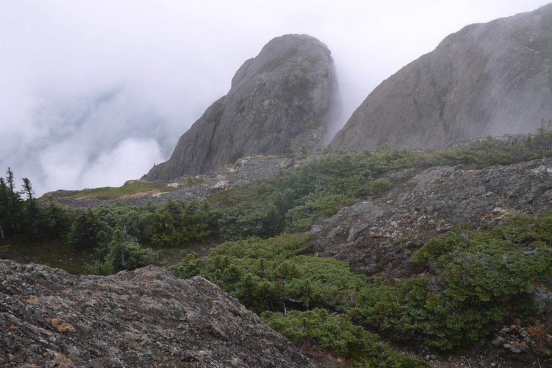
Steep alpine conditions on Mount Arrowsmith highlight why experience and preparation matter year-round. | Source: Andrey Skv
Today, Mount Arrowsmith remains a serious backcountry environment. Routes and access points exist, but conditions vary widely and can change quickly. Preparation here is less about checklists and more about mindset.
Safety messaging around Mount Arrowsmith aligns closely with broader backcountry best practices. Resources like AdventureSmart emphasize trip planning, communication, and preparedness as essential elements of responsible travel in remote terrain. These principles are especially important in areas where help may be distant and conditions unforgiving.
Mount Arrowsmith’s Role Beyond the Climb
Beyond recreation, Mount Arrowsmith plays an important environmental role in the Alberni Valley. Snowpack and rainfall collected at higher elevations feed rivers and aquifers that support surrounding ecosystems and communities, and form part of the Mount Arrowsmith Biosphere Region, where conservation and sustainable human activity are closely linked.
A Mountain with Many Stories
For many, Mount Arrowsmith is experienced from the valley below, where its presence is constant.
To hike Mount Arrowsmith is to move through a landscape shaped by many layers of history — cultural, environmental, and personal. Respect for the mountain means acknowledging its significance to the Tseshaht and Hupacasath First Nations who have stewarded the land for generations, as well as recognizing the realities that have challenged hikers over time.
For some, that respect is expressed through careful preparation and thoughtful decision-making on the mountain itself. For others, it comes simply from appreciating Mount Arrowsmith from below — watching its outline change with the seasons and understanding its influence on the valley without needing to climb it.
Hiking Mount Arrowsmith has never been about ease or spectacle. It is about engaging with a mountain that has earned its reputation over time — one that continues to draw people upward not because it is forgiving, but because it demands humility, patience, and respect.