Four Alberni Valley Hikes with Mountain Views
Discover these four view hikes in the Alberni Valley, ranging from easy to advanced.
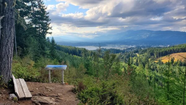
Source: Analise Satouris via Alltrails
Alberni Valley and Disappearing Lake
Skill Level: Beginner
Distance: 3.4km (2.1m)
Time to complete: 1hr 15min
Elevation: 187m (614ft)
Access: Park at the Alberni Inlet Trailhead. (map)
Discover stunning views of the Alberni Valley from this short, easy hike. Well maintained trails follow along the Alberni Inlet through to Disappearing Lake before turning back, taking about 1.25 hours to complete. This year round trail is used for hiking, biking and birding, and is also suitable for dogs. Some changing terrain and switch backs keep the walk interesting.
Great hike. Started at the Ship Creek Rd parking lot and hiked to the first logging road and then did a loop back to the main trail. Never really got to the Bluffs this time. I’ve been there before and it’s well worth it. – John via Alltrails
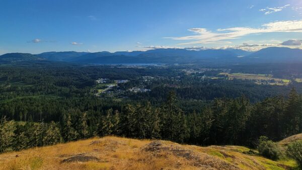
Source: Allie Nik via Alltrails
Alberni Forestry Loop
Skill Level: Intermediate
Distance: 5.1km (3.2m)
Time to complete: 2hr
Elevation: 296m (971ft)
Access: Park at Coombs Country Candy, walk 100m to trailhead. (map)
Scenic hike through mossy forest, lots of ferns, bluffs. Beautiful woodland vistas and superb views at 2 lookouts. A moderately challenging hike, this 5.1 km loop takes about 2 hours to complete. Some steeper terrain. Trail is used for hiking, horseback riding, and mountain biking. Dogs are welcome and may be off leash in some areas.
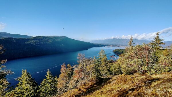
Source: Gerald Cuccio via Alltrails
Mount Hankin Bluffs Loop
Skill Level: Intermediate
Distance: 6.3km (3.9m)
Time to complete: 2hr 36min
Elevation: 432m (1417ft)
Access: Park off of Seizai Rd. (map)
Mount Hankin Bluffs Loop offers a beautiful view of Port Alberni Inlet. This moderately challenging route takes about 2.5-3 hrs to complete and is a 6.3 km loop. Discover excellent views with little streams and waterfalls along the way. While the trail is well marked and maintained, access points from logging road can be harder to find. Recommend bring map or downloading before starting.
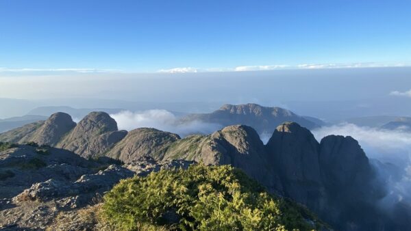
Source: Vaughn Mccall via Alltrails
Mount Arrowsmith via Judges Route
Skill Level: Advanced
Distance: 6km (3.7m)
Time to complete: 4hr 34min
Elevation: 1007m (3,304ft)
Access: Located 33mins from Port Alberni, take Highway BC-4 E(5.3km) to Loon Lake Main(2.7km), keep left and continue on Cameron Main(7.8km), turn left onto Pass Main(2.9km) (map)
Mount Arrowsmith is best enjoyed between the months of March through September, when snow is clear. This 6.0-km out-and-back trail is considered a challenging route, it takes an average of 4.5 hours round trip. Only those experienced with winter summiting should be hiking here during the deep winter. This is a difficult ascent, and most hikers should plan on a minimum of two hours of challenging climb to reach the peak. The trailhead is best accessed by driving up a logging road with four-wheel drive, though may be possible for some cars with good clearance. You will need to park and walk along the overgrown logging road to the trailhead entrance. Hikers should be prepared with good footwear and poles for managing the upward climb and poor trail conditions in places due to erosion. Steep sections should be assessed before proceeding, as there may be easier ways around on the left and right. The trail is well marked, and you can quickly get back on track if you opt for easier, alternate routes.
When you pass over the humps, you will spy a way finder sign between the two humps indicating your are near summit. Trek past the sign and continue up the mountain, where the trail follows some wooden steps. Successful hikers will be rewarded with beautiful views! Enjoy your rest at the top, and prepare for a slow descent. Dogs are welcome, but must be on a leash.